Jane’s Walk
Let’s get walking!
Jane’s Walk Huron is an annual event held across the County on the first weekend in May, rain or shine! The event encourages people to share stories about their neighbourhoods, discover unseen aspects of their communities, and use walking to connect with their neighbours.
Coordinated by Huron Cultural Office, Jane’s Walk Huron is part of the global Jane’s Walk Festival that takes place each year in hundreds of communities around the world. This movement of free, citizen-led walking conversations is inspired by Jane Jacobs (1915-2006), an American-Canadian writer, urbanist, and activist who championed a community-based approach to city-building.
2025 Walks
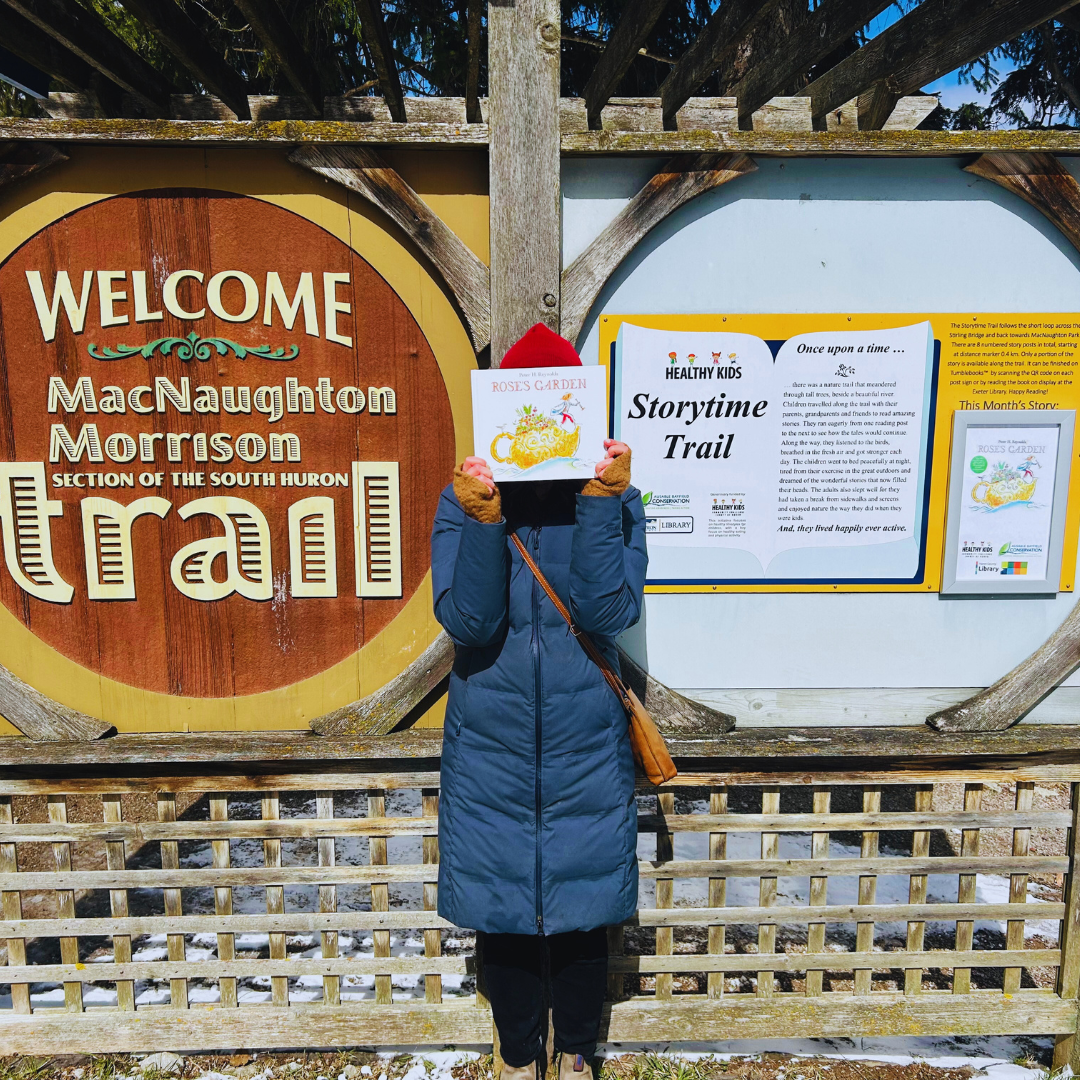
Wellness Walk along the Storytime Trail
Walk leader: Lauren Ihrig, Huron County Library
Date: Friday, May 2 | Rain or shine!
Time: 10:30 a.m.
Start/End: 62 MacNaughton Dr., Exeter, MacNaughton Park Pavillion
Walk length: 2 km taking about 1.5 hours.
Terrain/Accessibility: Uneven. Steep slopes. Fun for kids. Breaks offered along the way
Walk description: Join the Huron County Library and Ausable Bayfield Conservation Authority for an all-ages experience that celebrates connection to community and nature. Enjoy a leisurely pace on this walk that includes guided and self-guided elements. Mindfulness, sensory exploration and storytelling will feature during this event.
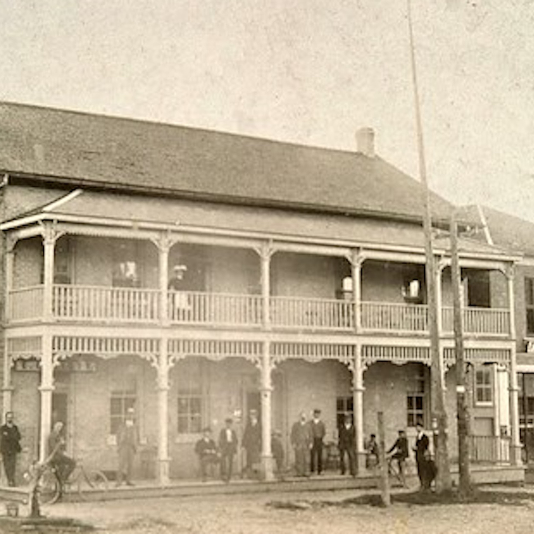
Bayfield’s Heritage Main Street: An Archival Tour
Walk leaders: Ben Woodward and Julia Armstrong
Date: Saturday, May 3 | Rain or shine!
Time: 11 a.m.
Start/End: 20 Main St. N., Bayfield, Archives and Heritage Centre
Walk length: About 1 hour
Terrain/Accessibility: Municipal sidewalks
Walk description: Bring along your mobile phone and explore the history of Bayfield’s Main Street through an augmented reality app. At the beginning of the tour, everyone will scan a QR code to download the free app developed by University of Waterloo graduate student Ben Woodward, who will provide assistance and lead the tour. Walk the two sides of Main Street and hold up our phones in front of various historic buildings to learn about their origins and see what they looked like in the past through the digitized collection of the Bayfield Historical Society. Walk participants will be invited to share feedback on the tool’s usefulness for learning about local history and built heritage.
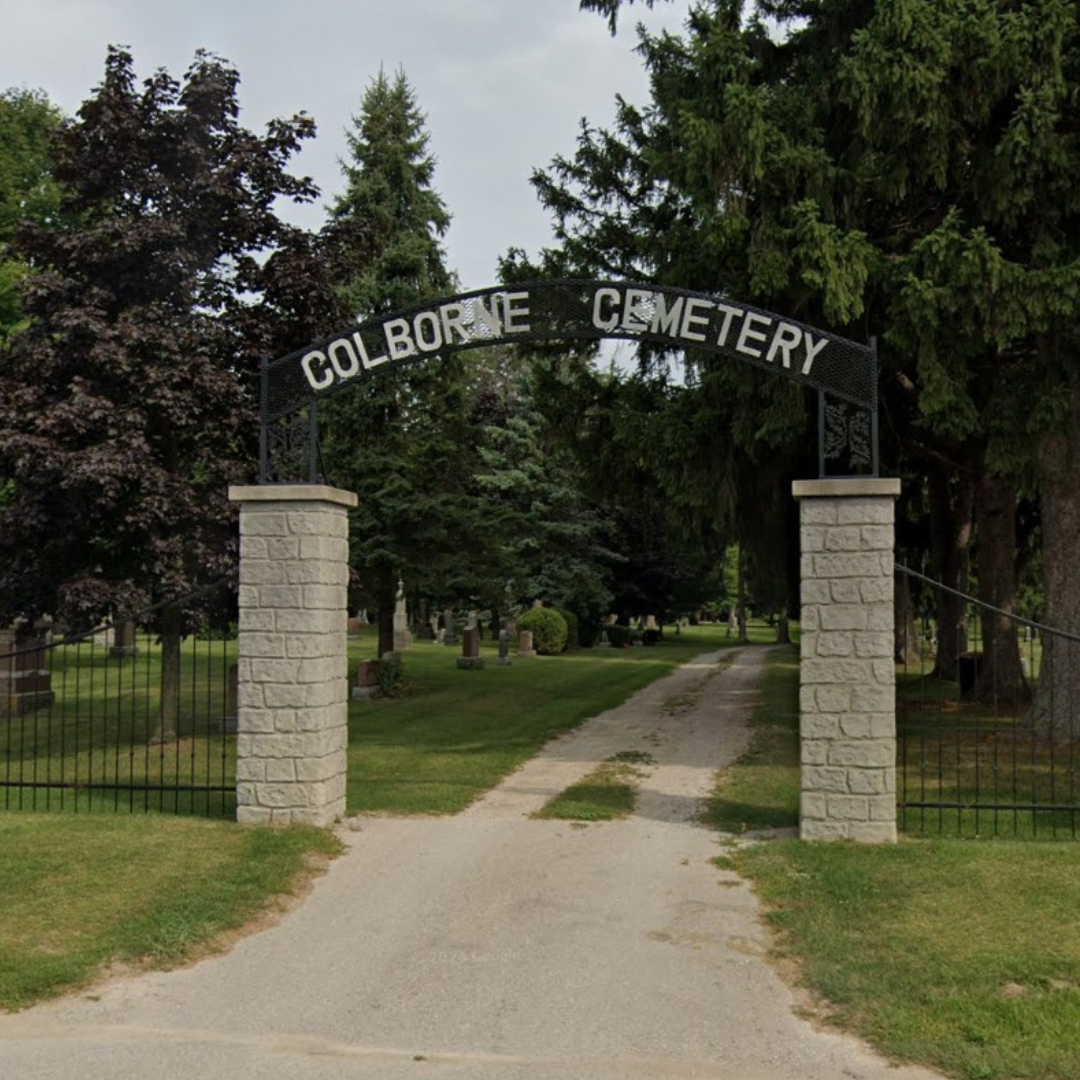
Cemeteries are Forever
Walk leader: Lindsay Whalen, Ontario Professional Planners Institute (OPPI) and student of Masters Science, Planning and Rural Development at University of Guelph.
Date: Saturday, May 3 | Rain or shine!
Time: 1 p.m.
Start: 36756 Saltford Rd., Colborne Cemetery. Meet at the front gates. Please note: If there is a funeral service that day, the alternative meeting and walk location is the Saltford Hiking Park (36739 Saltford Rd.), where we will walk the Saltford Hiking Trail.
End: 36739 Saltford Rd., Maitland Trail Head, includes a stop at St. Peter’s Cemetery before hiking down the Maitland Trail to the Hiking Park Loop and back to the Trail Head.
Walk length: 2 km taking about 1.5 hours.
Terrain/Accessibility: Uneven. Appropriate hiking footwear recommended. Colborne Cemetery entrance is accessible, however the lane, Maitland Trail and the Saltford Hiking Park are not.
Walk description: Explore the local history of burial plots, cemeteries, and the people and stories that have become enshrined in these quiet places. This walk will lift the veil on modern land use planning, policies and provincial laws that govern and conserve these spaces perpetually, forever. Come ready to share your own local cemetery knowledge or learn more while beholding the scenery.
Walk supported by the OPPI Southwest Chapter. All are welcome. OPPI members are also encouraged to participate and share input along the tour.
Important notes about access and parking:
Arriving by bike: Bikes can be secured at the cemetery entrance ahead of the tour.
Parking: Please do not park in the cemetery. All parking will need to be on the county road allowance. Please do not block the cemetery entrance for individuals that are not part of the walk and want to drive in and out of the cemetery during the day.
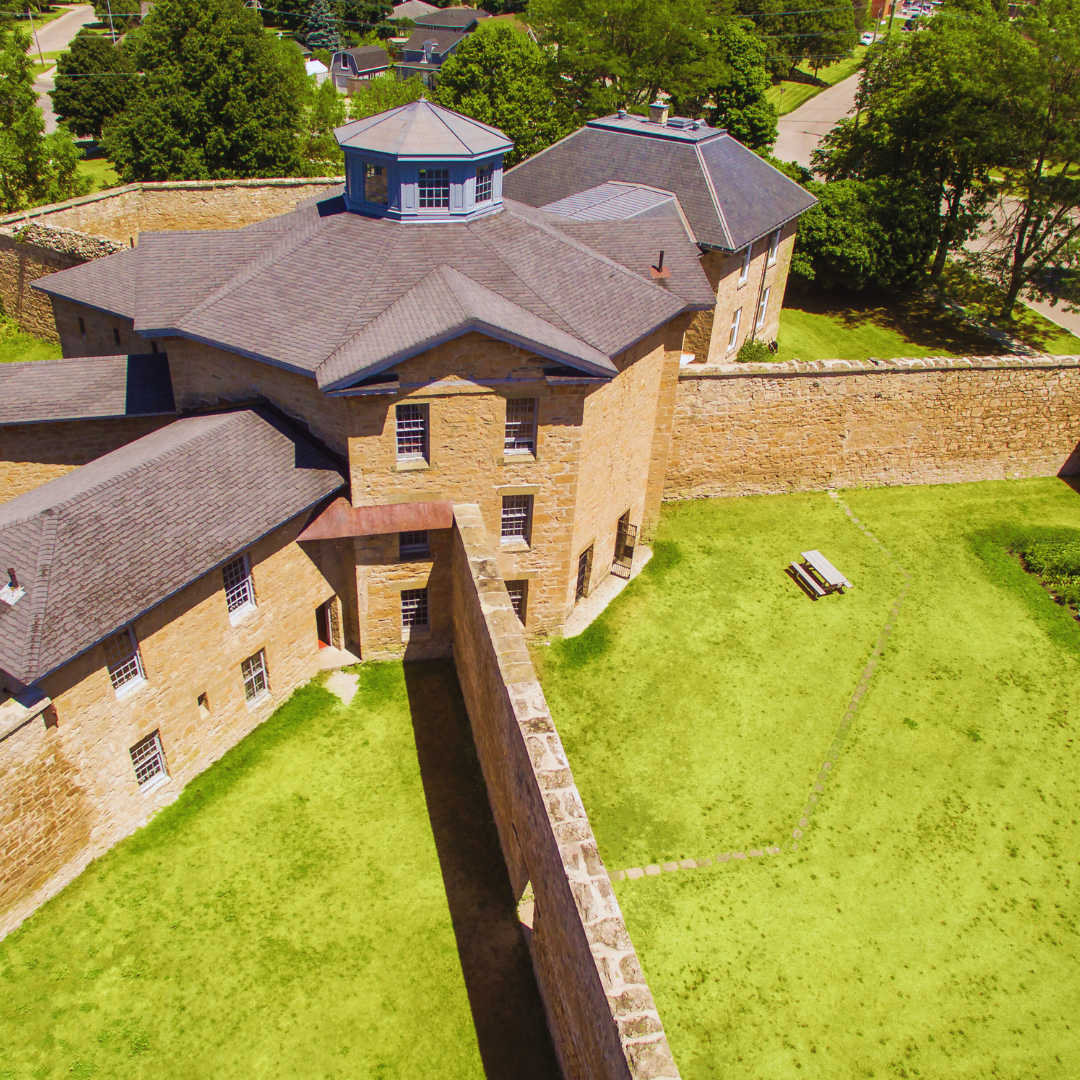
How the Jail was Saved
Walk leader: Sinead Cox, Huron County Museum
Date: Sunday, May 4 | Rain or shine!
Time: 11 a.m.
Start: 181 Victroria St., N., Goderich. Meet at the front entrance of the Governor’s House
End: 110 North St., Goderich, Huron County Museum
Walk length: 1 km taking about 45 minutes.
Terrain/Accessibility: Municipal sidewalks, lawn
Walk description: The Huron Gaol (jail) has been a landmark in the north corner of Goderich since construction began in 1839. Learn the history of this unique building and how the surrounding neighbourhood has changed in the last 185 years, including the story of this National Historic Site’s close call with demolition in the 1970s. Walk the Gaol grounds before walking up Gloucester Terrace to the Huron County Museum, with stops at historical points of interest in between.

Commercial Block Buildings Around the Square in Goderich
Walk leader: John Rutledge, Architect
Date: Saturday, May 3 and Sunday, May 4 (These walks explore the same content on both days so choose the day that fits best for your schedule)
Time: 1 p.m.
Start/End: 1 Courthouse Square, Goderich. Meet at the South Street Plaza in front of the Courthouse
Walk length: About 1.5 hours.
Terrain/Accessibility: Municipal sidewalks. No dogs please, except service dogs
Walk description: Explore the historic architectural styles that complete the Square’s perimeter streetscape. The eight-sided octagonal Square around the Huron County Courthouse is unique, being the only one of its kind in Canada and North America. Historically laid out by Tiger Dunlop and John Galt with the Canada Company, its circular radiating streets in all directions differ from ocean and lake port towns, which usually radiate from the docks in a semi-circular pattern. Over time, Commercial Block buildings were built completely ringing the Square with many types of historic Victorian architecture.